Pfeiffer Falls & Valley View Trails
Introduction
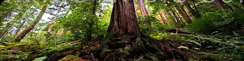
When you visit Pfeiffer Big Sur State Park, this is the first trail staff usually suggests, and rightly so. A perfect, though slightly challenging hike for both kids and older folks, you get to walk among the giant redwoods and visit a rocky waterfall.
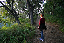
Those looking for a bit more of a workout can hike up through the picturesque oak trees to the overlook bench, with expansive views of the Big Sur River gorge.
Hike Facts:
• Length: 2 miles
• Type: Out & Back
• Difficulty: Easy/Moderate
• Path: Good, rugged in spots
• Elev. Gain: 450 feet
• Parking Fee: Yes
• Restrooms: Yes
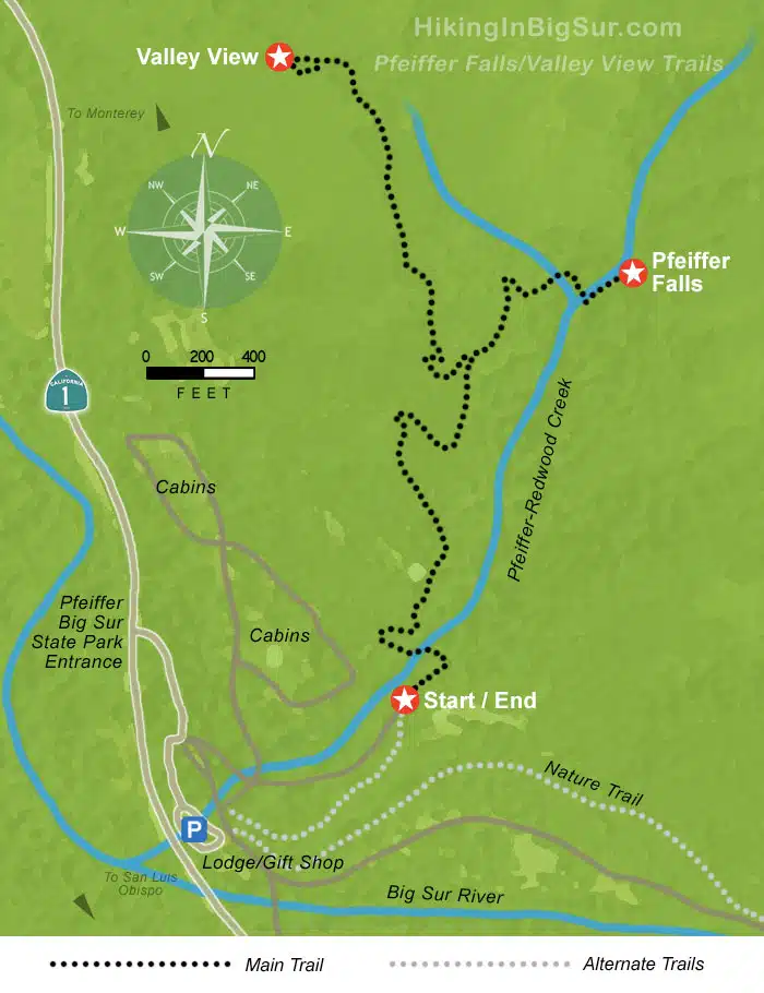
Pfeiffer Falls Hiking Trail Map
The Hike
There are two places to begin the Pfeiffer Falls & Valley View hike, depending on where you parked. If after paying the fee and entering the park you turned right towards the lodge front desk, and parked in the lot opposite the gift shop and lobby, then you’ll want to head up the road that goes east directly away from Highway 1 into the forest. Just a few yards up this road will be a sign on the right marking the start of the trail from this point. (You can also stay on the road and pick up the trail after a hundred yards or so).
If you entered the park and went straight past the lodge and continued on, there are several parking lots on your right. You’ll want to back track along the road and look for the trail entrance on your right opposite the lodge.
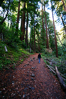
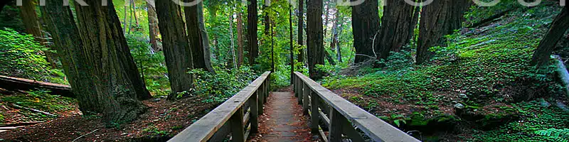
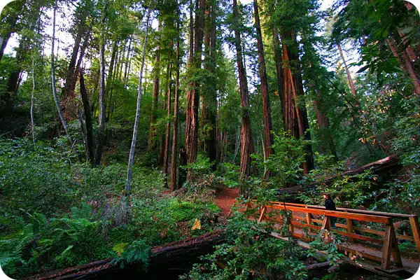
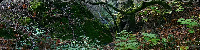
The wide and well-maintained trail begins with a modest climb through the majestic redwoods, walking among the patches of clover-like redwood sorrel along the creek. After a short distance, you’ll see where the trail crosses a bridge to the left to start up the side of the canyon.
After a short steep climb you’ll see the spur to the Valley View overlook to the left. It’s another steep but short climb to the top where a viewing bench has been placed in a perfect spot for looking northwest out to the ocean.
Surprisingly, cell phone service (at least Verizon and ATT which I’ve used) works great up here, and the overlook may be a fun place to call your pals at home and make them wish they were with you.
Also notice the splendid examples of native oak trees along this part of the trail, especially up along the ridge to the lookout bench.
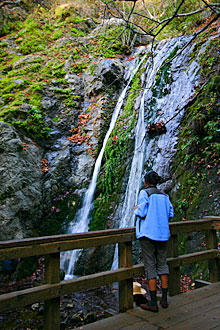
From the lookout, head back down to the fork and this time go left towards the falls. The trail will wind down the hill and eventually drop you back into the redwoods where you’ll cross over the creek one last time and see the falls on your left.
After checking out the falls, you’ll head back the way you came and go left at the fork, returning to the lodge and parking lot.
Getting There
The beginning of this trail is in the Pfeiffer Big Sur State Park. Look for the main entrance sign on the inland (east) side of Highway 1 about 26 miles south of Carmel, or 63.5 miles north of the Hearst Castle turnoff.
Links To More Information
• Where this trail lies along the Big Sur coast
• Official Ca. Parks & Recreation page
Big Sur Hiking Trails Essentials
🚗 Do I need to rent a car for Big Sur?
Absolutely! I recommend renting through Discover Cars.
✈️ For best flight deals check Kiwi.com
💦 Stay Hydrated on the trails! I recommend this Brita water bottle.
🌞 Protect Yourself from the Sun ! Here’s my favorite SPF.
👟 Invest in a good pair of hiking shoes. Best for men and women.
🎁 Looking for a Gift for a Hiker in your Life? Here’s 40 Best Gifts For Hikers
🔎 Pack a pair of binoculars! Enhance your wildlife viewing experiences with a pair of binoculars.
📸 Capture Every Moment!
A camera strap is a must-have for hands-free convenience while hiking. Also, pack an extra memory card so you never run out of space for your stunning photos.
🏠 Where should I stay in Big Sur? Browse on Booking.com and VRBO. For a special experience, check out my guide on best glamping in Big Sur!
🚐 Interested in an RV experience? RVshare and Outdoorsy are fantastic platforms to find the perfect RV for your Big Sur adventure.
🎧 Download a self-driving audio tour of Big Sur here


Visiting Carmel area at end of June beginning of July. Looking for easy to moderate walks/hikes and best trail to see Redwoods