Salmon Creek Trail
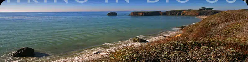
One of the southernmost popular Big Sur trails, Salmon Creek offers a nice steady workout in addition to some of the most expansive views westward toward the coast.
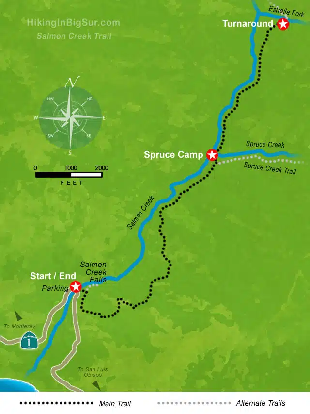
This is also a trail that you can hike as long as you like, turning back when you run out of steam, or stopping at either the Spruce (2 miles in) or Estrella (3.25 miles in) camps for a nice break before turning back.
Hike Facts:
• Length: 4-6.5 miles
• Type: Out & Back
• Difficulty: Moderate to hard
• Path: Good, rugged in spots
• Elev. Gain: 1,300 feet
• Parking Fee: No
• Restrooms: No

Salmon Creek Trail Map
The Hike
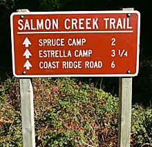
After parking, walk south to the trailhead clearly marked with the sign pictured at right. You’ll walk a short distance inland and see a fork where the Salmon Creek trail heads up the hill to the right.
If you take the left fork, the trail heads down to a scenic jumble of rocks under the trees where Salmon Creek Falls form several pools. This short diversionary path dissipates near the falls, but is worth a look, and might be just right for a quick hike if you don’t have time for the complete and more challenging trek.
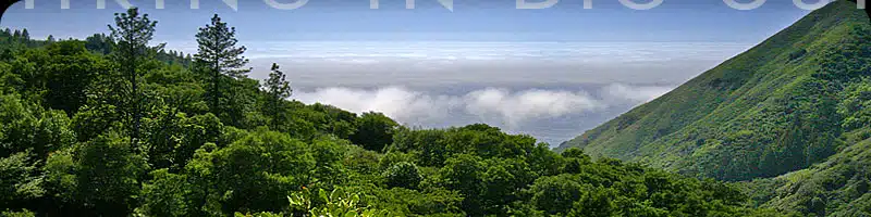
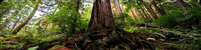
Back on the main trail, you’ll head up the side of the canyon for some steep hiking and great views over Highway 1. The trail steadily heads up and east, threading in and out of small side canyons as you make your way through open grassy areas and beguiling oak forests.
Each time you head out of a side canyon, you’ll have another magnificent wide open view west towards the coast. There are a few spots where the trail crosses patches of rocky hillside, but the footing is generally steady all the way to Spruce Camp.
At just about 2 miles in, there will be a fork where the Spruce Creek trail heads off to the right. Instead, head left a short walk down to Spruce Camp which sits alongside Spruce Creek.
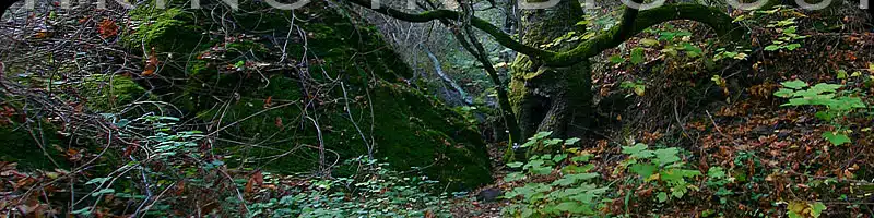
This could serve as a turnaround spot to make this a 4 mile hike, or you can continue across the creek and hike the remaining mile along Salmon Creek up to Estrella Camp. Look for short detours on the left along this last segment, which lead to more scenic falls and pools along the creek.
If you can keep going all the way to Estrella Camp, this last stretch is highly recommended. You’ll get several glimpses of waterfalls and pools along rocky Salmon Creek. The trail will climb higher and higher and eventually end up in a small meadow with campsite and several side detours down to the creek.
There is a rock slide in one spot along here, and though the path has been reconstituted, use caution. The slope down to Salmon Creek is incredibly steep in places, so you’ll always want to keep your balance.
At the first Estrella campsite, go right and head down towards the water for a great place to relax and another camping area. The trail continues on the other side of this second campsite, and climbs 3 miles to Coast Ridge Road.
As you head back, you’ll experience view after view out Salmon Creek canyon towards the ocean.
Alternate Exploring
At Estrella Camp, the trail continues and eventually meets up with the South Coast Ridge Road 3 miles further on after a steady climb. However, overgrown trail conditions may limit all but the most persistent hikers.
If you didn’t check it out on the way in, make sure to take the detour to Salmon Creek Falls near the start of the trail.
The currently dormant Salmon Creek ranger station and parking lot can also be found a few hundred feet north of the Salmon Creek trailhead along the highway and can provide access to the usually overgrown Buckeye trail or a shady spot for your car if the gravel pullout is full.
Getting There
This trail starts from a pullout on the inland side of Highway 1, 3.6 miles north of the Ragged Inn or 18.6 miles north of the Hearst Castle turnoff.
Travelling south on Highway 1, the pullout is 45 miles south of Pfeiffer Big Sur State Park Entrance or 7.9 miles south of Gorda. The parking area is not paved, but fairly obvious, located right along the highway at the apex of the biggest hairpin turn in the area.